Coyote Creek Parkway North:
11.3 miles one-way plus a 1.1 mile on-street gap connection. Wheelchair users on most of the trail.
From: Williams Street
To: Metcalf Park in San José
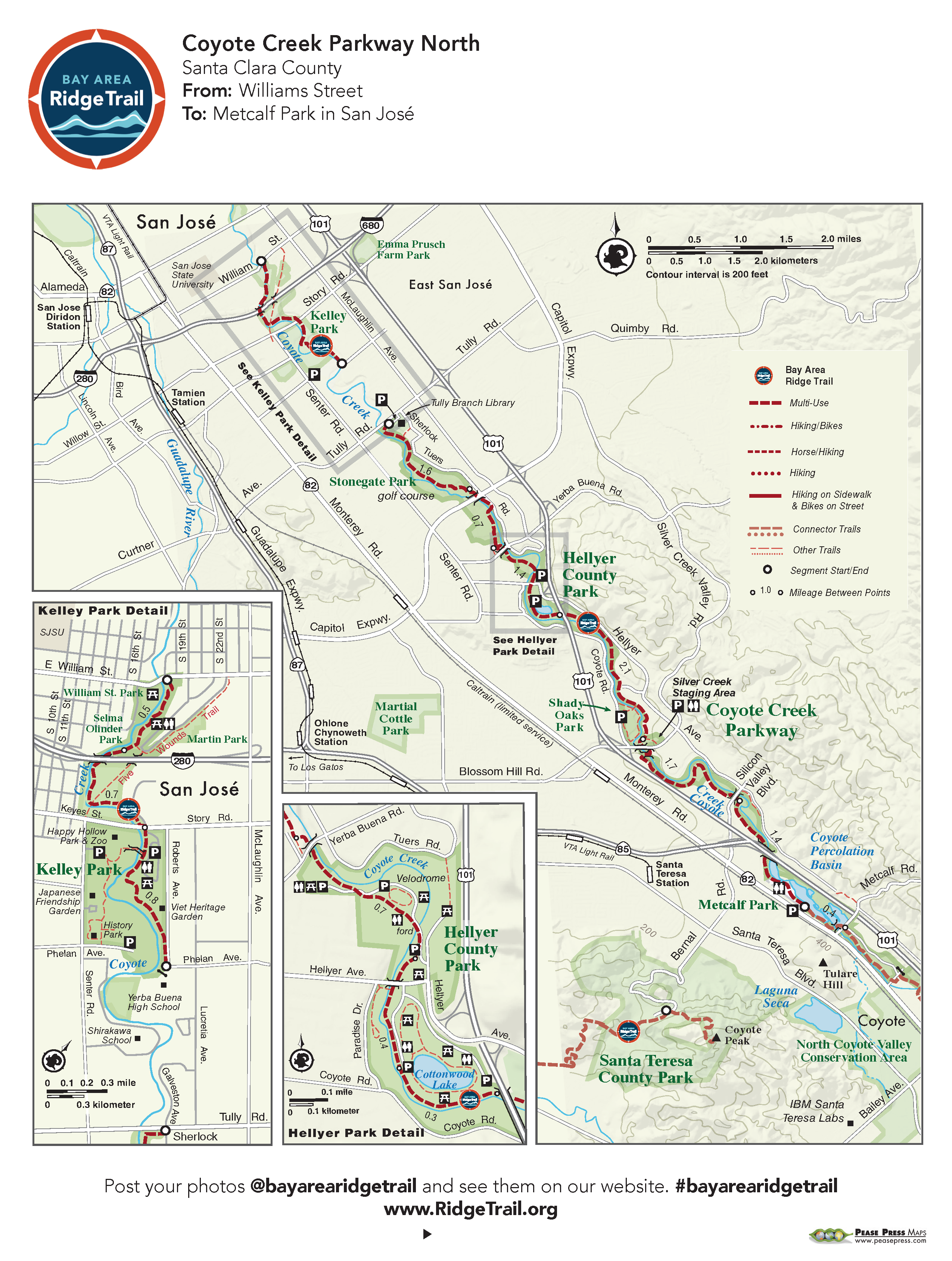
Coyote Creek travels 31 miles from the Diablo Range to San Francisco Bay. On this trail segment, follow the creekbed through shady riparian cover, parks, developed areas, and open fields to Metcalf Park’s freshwater lagoons, the habitat for many year-round and migratory bird species. The wide paved trail travels a nearly level course and is an excellent bike ride, popular with families on bicycles, especially on weekends. A short, 1.1-mile on-street detour will lead you to the last section
of the trail from Phelan Ave to Williams Street.
Elevation Gain/Loss 145 feet/80 feet one-way
OuterSpatial Mobile Map: Click Here
Must have the OuterSpatial app for the link to take you directly to the mobile map page.
This trail description is excerpted from the 2019 Guidebook. For details on all trails, trailheads and more buy the book from Wilderness Press.
For more resources to plan your trip, visit our Trail Tools page.