Rockville Hills Regional Park and Vintage Valley Trail:
4.2 miles one-way for hikers and mountain bikers, 0.8-mile one-way for equestrians; car shuttle possible.
From: Rockville Road
To: Antiquity Drive in Fairfield
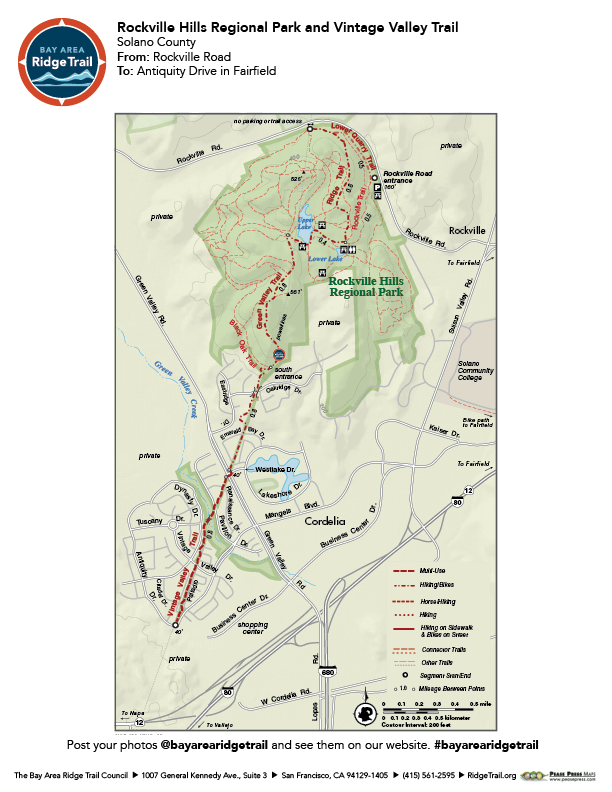
Climb gently through volcanic hills to a remote, grassy valley with a splendid stand of blue oaks. Then ascend to a plateau with views of Mount Diablo, Elkhorn Peak, and the Twin Sisters. The trail then drops into and through a residential subdivision. This trip begins on a connector trail to the park’s north entrance and then travels paved and unpaved service roads to a paved trail through the subdivision. Most trees in the park are deciduous, so on a winter day the trails can be comfortably sunny, yet in summer the blue-oak forest offers welcome shade.
Elevation Gain/Loss 540 feet/580 feet one-way
OuterSpatial Mobile Map: Click Here
Must have the OuterSpatial app for the link to take you directly to the mobile map page.
This trail description is excerpted from the 2019 Guidebook. For details on all trails, trailheads and more buy the book from Wilderness Press.
For more resources to plan your trip, visit our Trail Tools page.