Mount Burdell Open Space: O'Hair Park to Olompali State Park:
4.2 miles one-way (plus 4.2-mile return to Novato Boulevard) or 2.9 miles one way (plus 2.9-mile return to San Andreas Drive for mountain bikers; alternate return route possible)
From: Novato Boulevard or San Andreas Drive
To: Mount Burdell Summit in Novato
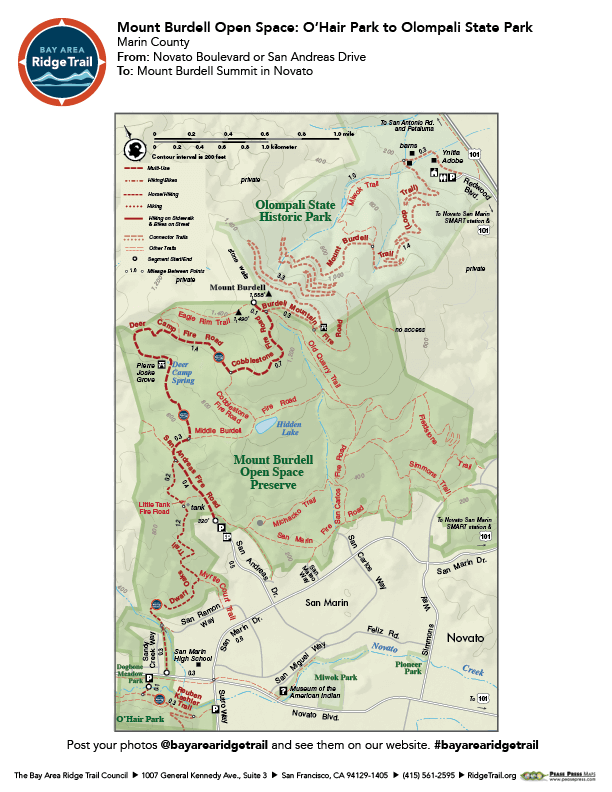
Climb through grasslands dotted with ancient oaks to spectacular vistas of North Bay ridges from the slopes of 1,558-foot Mount Burdell. The largest of Marin County Open Space District’s holdings, these 1,627 acres of oak savanna and grasslands are interspersed with dense woodlands. Hikers and equestrians can begin from Novato Boulevard and cross a sensitive wildlife area on the Dwarf Oaks Trail. Mountain bikers join them at San Andreas Fire Road, and all users follow wide fire roads to the peak; the trails are steep and rocky, with little shade. Summers are hot here, so be sure to get an early start.
Elevation Gain 1,400 feet one-way (from Novato Boulevard); 1,200 feet one way (from San Andreas Drive)
OuterSpatial Mobile Map: Click Here
Must have the OuterSpatial app for the link to take you directly to the mobile map page.
This trail description is excerpted from the 2019 Guidebook. For details on all trails, trailheads and more buy the book from Wilderness Press.
For more resources to plan your trip, visit our Trail Tools page.