Mount Madonna County Park:
3.5 miles one-way; car shuttle possible
From: Sprig Recreation Area Entrance
To: Old Mt. Madonna Road in Gilroy
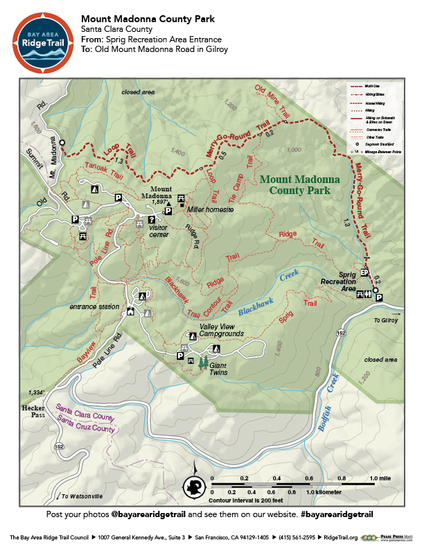
On an uphill trip from the Sprig Recreation Area trailhead to Mount Madonna Road, you take in excellent views of southern Santa Clara County and the Inner Coast Range. The wide service road skirts an intermittent creek, crosses boulder-strewn grasslands, swings through chaparral and scrub-oak forest, and finishes in a cool, steep-sided redwood canyon. This is the southernmost segment of the Ridge Trail.
Elevation Gain/Loss 1,150 feet/160 feet one-way
OuterSpatial Mobile Map: Click Here
Must have the OuterSpatial app for the link to take you directly to the mobile map page.
This trail description is excerpted from the 2019 Guidebook. For details on all trails, trailheads and more buy the book from Wilderness Press.
For more resources to plan your trip, visit our Trail Tools page.