Santa Teresa County Park and Calero/Los Alamitos Creeks Trail:
7.1 miles one-way (plus 1.1 mile return trip from Coyote Peak); car shuttle possible. Wheelchair users can use Calero Creek and Los Alamitos Trails.
From: Pueblo Day Use Area
To: Almaden Quicksilver County Park
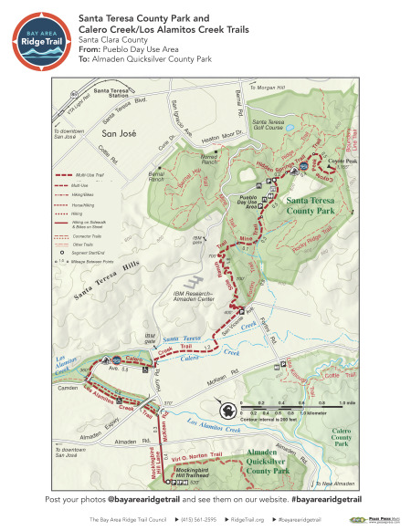
The Ridge Trail route branches east and west through Santa Teresa County Park. Take the trail east through high, oak-studded grasslands up to Coyote Peak. Then head back west on well-graded, exposed paths, past spring wildflower displays, serpentine outcrops, and Coast Range views. Listen to the sound of running water on the tree-lined Calero Creek Trail, and continue on the wide, paved, partially shaded Los Alamitos Creek Trail. Follow McKean Road and Mockingbird Hill Lane to continue on to Almaden Quicksilver County Park. Note: The trail through Santa Teresa County Park is exposed and can be hot in summer and early fall.
Elevation Gain/Loss 805 feet/1,020 feet (includes round-trip to Coyote Peak)
OuterSpatial Mobile Map: Click Here
Must have the OuterSpatial app for the link to take you directly to the mobile map page.
This trail description is excerpted from the 2019 Guidebook. For details on all trails, trailheads and more buy the book from Wilderness Press.
For more resources to plan your trip, visit our Trip Planning Tools page.