Sierra Vista Open Space Preserve: Sierra Road to Lower Calaveras Fault:
4.9 miles one-way (plus a 4.2-mile alternative return route)
From: Sierra Road Staging Area
To: Lower Calaveras Fault Trail Vista Point in San José
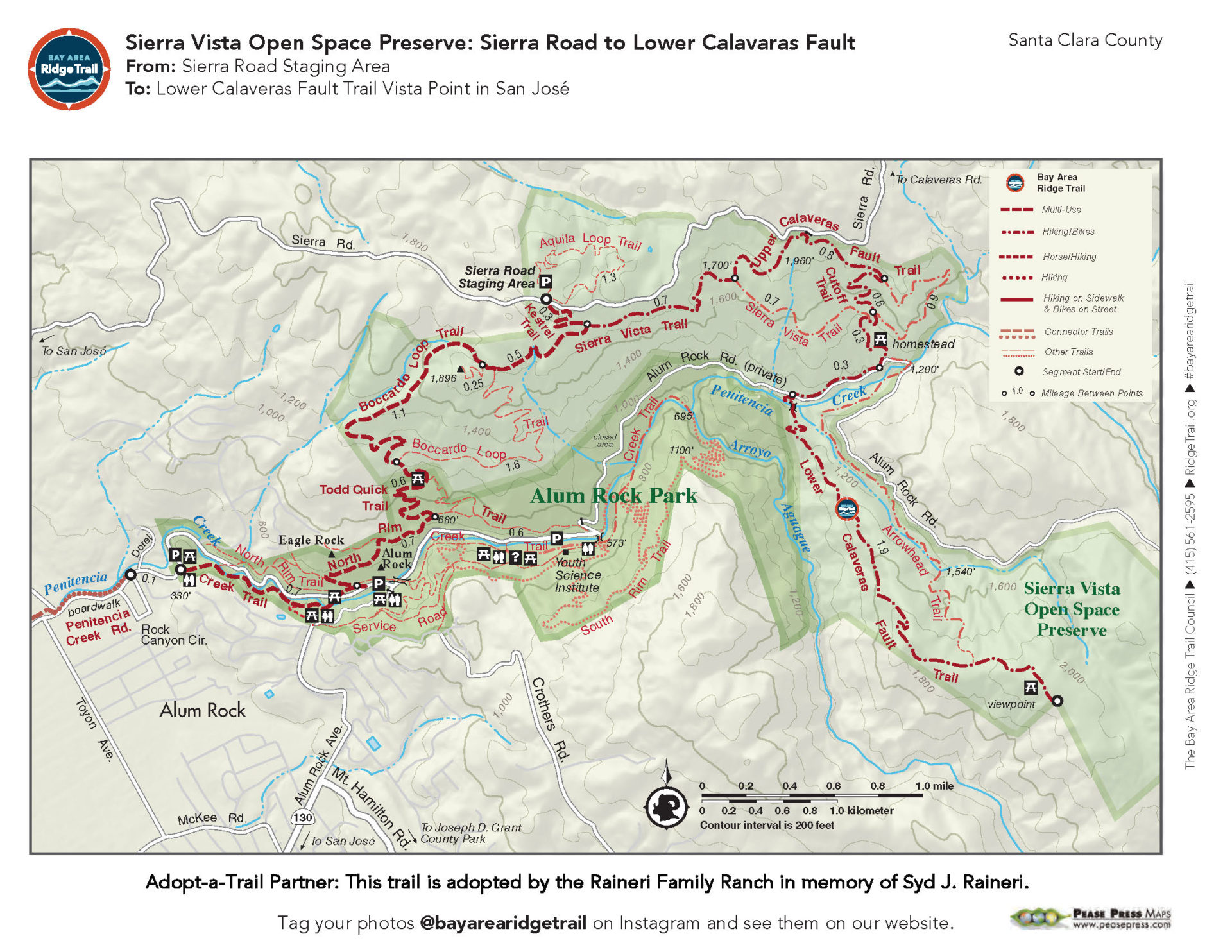
The Sierra Vista Trail opened in 2011, connecting the Ridge Trail at the lower elevations with the Upper and Lower Calaveras Fault Trails, and creating a long 8.9-mile Ridge Trail segment. This upper Ridge Trail section starts high up on the grassy ridge, with spectacular views of the Santa Clara Valley, and then follows the contours of the steep Alum Rock Canyon before dropping down to Penitencia Creek and climbing out to another ridgetop to the southeast. The end point has sweeping vistas of the valley below and the hills to the east. This is a very exposed trail for much of the route, so start early on hot days.
Elevation Gain/Loss 1,290 feet/1,210 feet one-way
OuterSpatial Mobile Map: Click Here
Must have the OuterSpatial app for the link to take you directly to the mobile map page.
This trail description is excerpted from the 2019 Guidebook. For details on all trails, trailheads and more buy the book from Wilderness Press.
For more resources to plan your trip, visit our Trail Tools page.